Chief Operating Officer of Smart Tech - Arun Kumar Pokhrel
28 November 2023

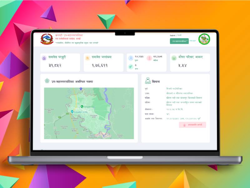
Smart Tech Nepal Pvt. Ltd. proudly introduces Digital Profile, a cutting-edge web application designed to revolutionize local governance with GIS technology. This innovative platform serves as a comprehensive Municipal Profile Management System, empowering both local governments and citizens alike. Through seamless digital integration, Digital Profile enhances efficiency and transparency in community interactions with government services.
At its core, Digital Profile streamlines municipal operations, offering a centralized hub for managing diverse aspects of local governance. Leveraging GIS technology, the platform provides intuitive tools for mapping and analyzing spatial data, enabling authorities to make informed decisions regarding infrastructure planning, service provision, and resource allocation.
Moreover, Digital Profile fosters citizen engagement by providing a user-friendly interface for accessing government services and information. From submitting service requests to accessing real-time updates on local projects and initiatives, citizens can interact with their government conveniently and transparently. By bridging the gap between local governments and their constituents, Digital Profile empowers communities to collaborate towards building sustainable and inclusive urban environments.
In addition to its GIS capabilities and comprehensive municipal management features, Digital Profile integrates advanced data analysis tools, including pie charts, to provide insightful visualizations of local data. These pie charts offer stakeholders a clear and concise representation of various aspects of community dynamics, allowing for deeper understanding and informed decision-making.
Through the inclusion of pie charts, Digital Profile facilitates the presentation of key metrics related to demographics, infrastructure, service delivery, and more. Users can easily interpret complex data sets at a glance, identifying trends, disparities, and areas for improvement within their locality.
By combining GIS technology with data visualization tools like pie charts, Digital Profile equips local governments and citizens with the means to analyze, interpret, and act upon data-driven insights effectively. This enhanced understanding empowers stakeholders to devise targeted strategies and policies that address the evolving needs and priorities of their community.
Certainly! In Digital Profile, the GIS mapping feature with categories and search filters plays a pivotal role in providing users with an intuitive and comprehensive view of various facilities and services within the community, including hospitals and health posts.
When users access the GIS mapping feature, they can easily navigate through different categories of locations, such as healthcare facilities, schools, public amenities, and more. Each category is represented by distinct markers or icons on the map, making it effortless for users to identify specific types of establishments.
To locate a hospital or health post, users can utilize the search filter functionality. They can input relevant keywords such as "hospital" or "health post" into the search bar, triggering the display of corresponding locations on the map. Additionally, users can apply filters to refine their search based on parameters like proximity, services offered, or ratings.
Once a hospital or health post is selected, Digital Profile provides users with detailed information about the facility, including its name, address, contact information, operating hours, available services, and any additional relevant data. Users can also access directions to the chosen location, facilitating easy navigation.
Overall, the GIS mapping feature with categories and search filters in Digital Profile offers users a convenient and efficient way to explore healthcare facilities like hospitals and health posts within their community. By providing comprehensive information and intuitive navigation tools, Digital Profile enhances accessibility to essential services and promotes informed decision-making for both citizens and local government authorities.